Urban Tides Give Rise to Community Resilience
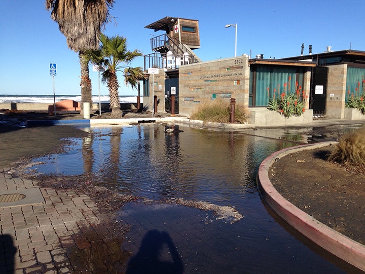
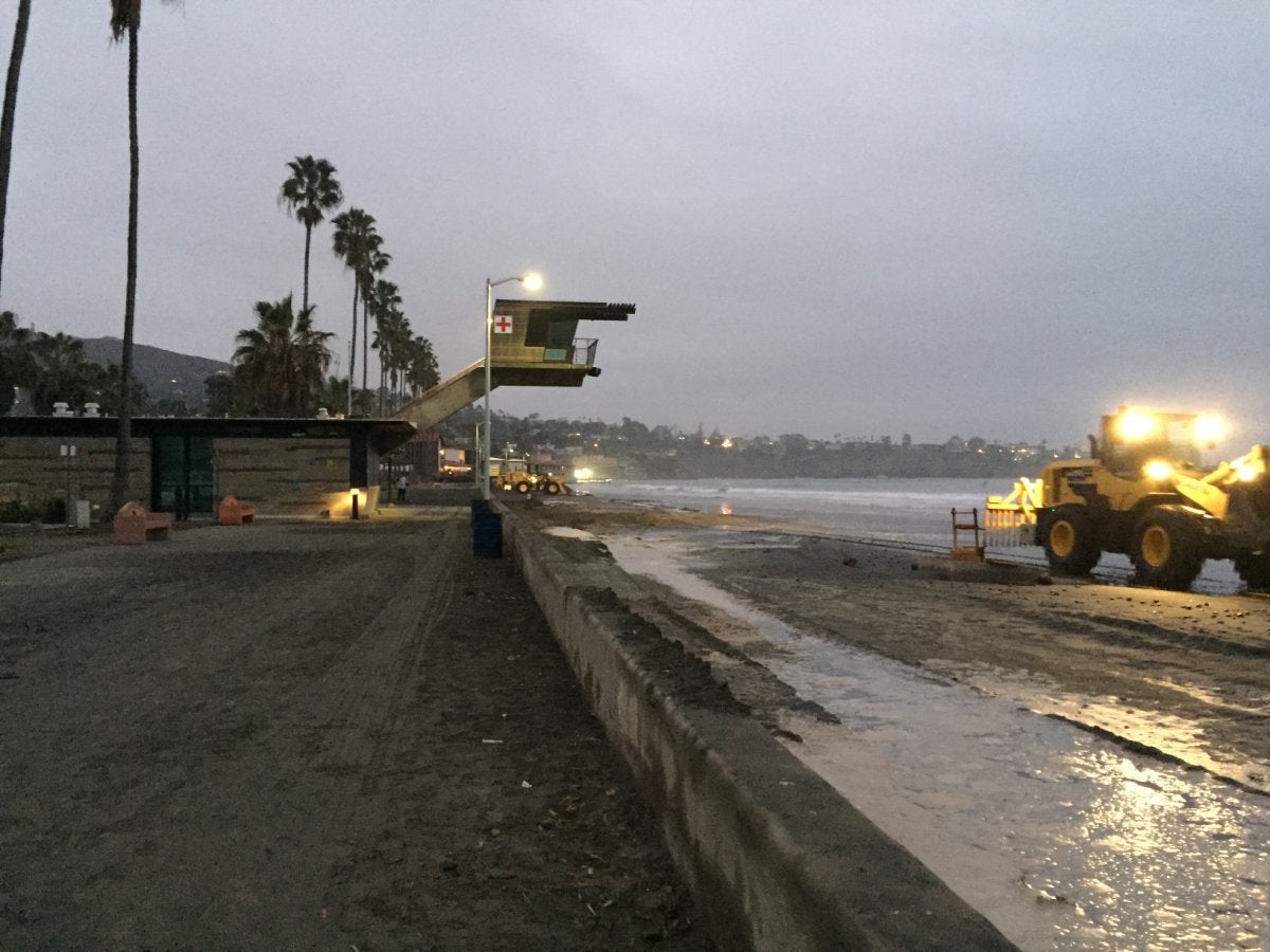
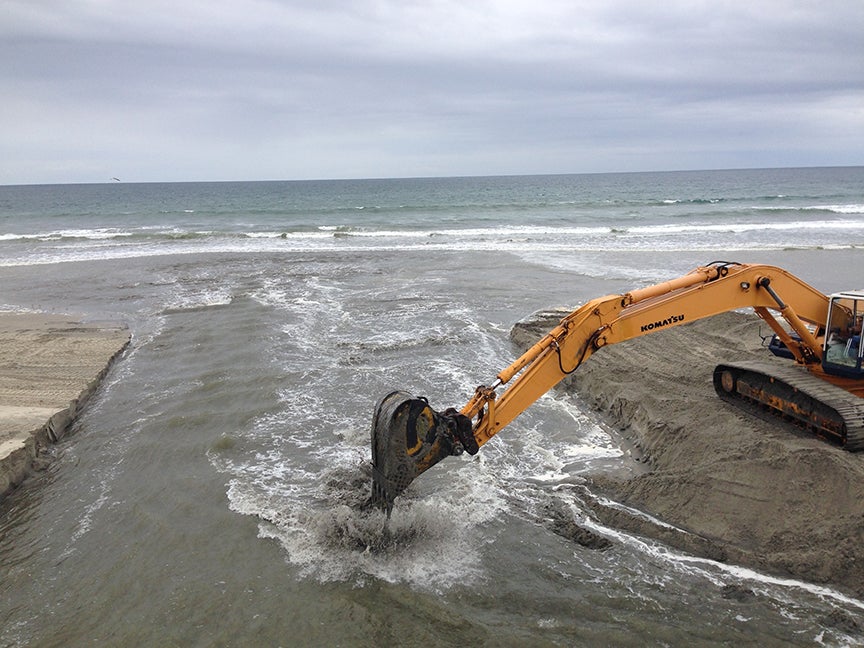
At its peak, the king tide swallowed the entire beach, pushed past a low seawall, spilled across the bike path, and flooded the parking lot. Just past sunrise, heavy mist still lingers in the air as a group of volunteers walk along this stretch of beach in San Diego, CA. About 20 people – mostly coastal residents along with a handful of scientists and graduate students – have gathered to photograph evidence of flooding and erosion due to the extreme high tide. Bulldozers are already in motion removing sand.
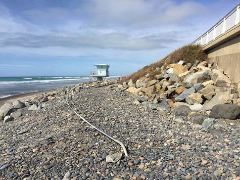
This is a scene that will become more familiar with sea level rise. Sea level rise in Southern California is expected to match global projections with an increase of 5-24 inches by 2050 and 17-66 inches by 2100. The combination of high tides, winter storms, and El Niño conditions that bring warmer ocean water and therefore higher water levels, give us a glimpse of what future sea level rise will look like in our beach communities. Impacts include coastal flooding, damage to infrastructure such as roads and sewage treatment plants, erosion of beaches and cliffs, and loss of habitat for wildlife.
USC Sea Grant is building resilience in coastal communities with a new citizen science program called the Urban Tides Community Science Initiative. Launched in 2015, Urban Tides links the observations of community members across Southern California with scientists and city leaders working on climate change.
Visualizing risks through images of flooding and erosion enables community members and local governments to set priorities as they plan strategies that will help the region adapt to the impacts of sea level rise.
Urban Tides increases ocean and climate literacy, and effectively invites more voices into the discussion of how we can adapt to rising seas,” says Linda Chilton, education programs manager at USC Sea Grant.
Urban Tides is as simple as walking along the beach and snapping a photo. The goal is for community members to photo-document tidal lines, coastal flooding, and erosion, and upload images into the Urban Tides database. Researchers then determine the water level from each photo and use it to help ground truth and calibrate that project the locations and severity of flooding and erosion due to future sea level rise and coastal storms. These models are output as maps and become critical tools to help communities adapt to rising seas and protect vulnerable infrastructure and people along the coast.
USC Sea Grant and scientists at U.S. Geological Survey developed to ensure quality, usable data is collected. Additionally, USC Sea Grant led the development of a unique database and mobile app that uploads images, GPS location, and other critical observations with just a few clicks. The app is linked to an interactive data portal that shares images and results with all participants.
USC Sea Grant has built partnerships with more than 25 non-formal education centers, scientists, schools, nonprofit organizations, and local municipalities in Southern California to engage communities in this effort.
Back on the misty beach in San Diego, Linda Chilton and Dr. Sarah Giddings with Scripps Institution of Oceanography, continue to lead the beach walk and discuss observations. The dialog that opens up within the group touches on the causes of El Niño, natural shorelines as buffers to sea level rise, and California’s ongoing drought, among other topics. Leading beach walks has become a core element of Urban Tides, bringing together scientists, residents, students, and managers to spark conversation about our changing coastline.
“I think it is great when scientists are willing to collaborate with the public and invite them into their ‘labs’,” says Brie Iatarola, a graduate student at UC San Diego. “This is a great way to keep a conversation going about the short- and long-term impacts of beach erosion, extreme tides and El Niño.”
More than just a data collection platform, Urban Tides is a way for individuals to engage in meaningful science. It’s a way to raise public awareness and create a discussion – at the community level – about sea level rise impacts and adaptation.
View a slideshow of images from winter 2016 and find out more on the Urban Tides Initiative.


