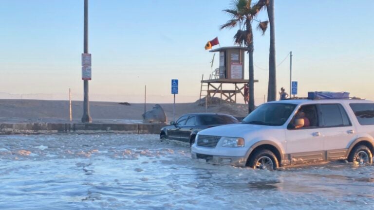
Balboa Penninsula’s parking lot flooded on July 3, 2020. Photo courtesy Newport Beach Mayor Will O’Neill
Summer Storms Reveal a Century-Long Battle
On July 4th weekend, Balboa Peninsula experienced its worst swell of the year thus far, causing extensive flooding, property damage, and near-death ocean rescues by the Newport Beach Lifeguards. The Ocean County Register reported knee-deep flooding, reaching up to three blocks inland. Among the many damages, the parking lot at Balboa pier was completely flooded, houses experienced inundation, and a large sailboat forced ashore was destroyed.
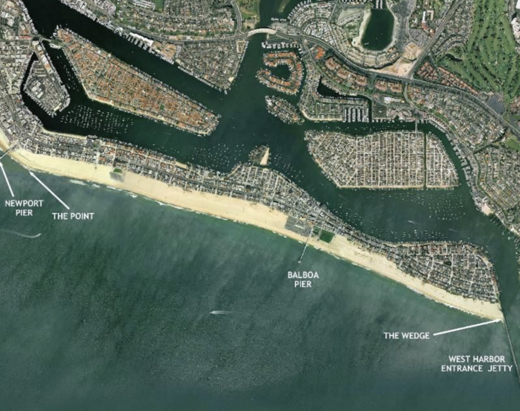
Balboa Peninsula, a 3-mile long sand spit separating Newport Beach from the Pacific Ocean, contains sandy beaches and coastal foredunes backed by low-lying residential and commercial development. The beach is a popular recreation destination, especially near the areas with public parking lots. Additionally, surfers flock to the Peninsula at sites such as “The Point” on the west end and “The Wedge” at the east.

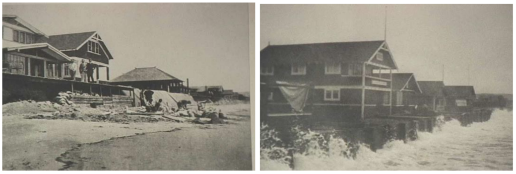
Balboa Peninsula has long dealt with persistent challenges surrounding coastal flooding. The peninsula itself is built of dredged sand and silt and sits below the high tide line. As far back as 1912, the City of Newport Beach began construction of sea walls to protect coastal homes from wave action during storms and high tides. In the 1930s, the City conducted multiple sand replenishment and beach stabilization efforts. By the 1960s, construction along the beach improved beach slope, height, and created groins to mitigate sand loss. Starting in the 1970s, the City began constructing seasonal beach berms to protect low lying infrastructure against seasonal storms.
Today, the city’s response has evolved to regular beach berm building in advance of all predicted high tides and storm events. City staff and on-call contractors coordinate the construction of these temporary berms to protect structures from wave uprush and mitigate damage to coastal access and resources.

While coastal flooding has been addressed throughout Balboa’s history, an issue of increasing concern for the region is sea level rise. According to the National Oceanic and Atmospheric Administration (NOAA), the area has already experienced 8.8 inches of sea level rise over the last 100 years. The City began its first sea level rise assessment in 2006. This laid the foundation for a continuing policy, which includes monitoring high tides and wave events to determine berm building, modeling predicted sea level rise, and reviewing building codes in flood sensitive areas.
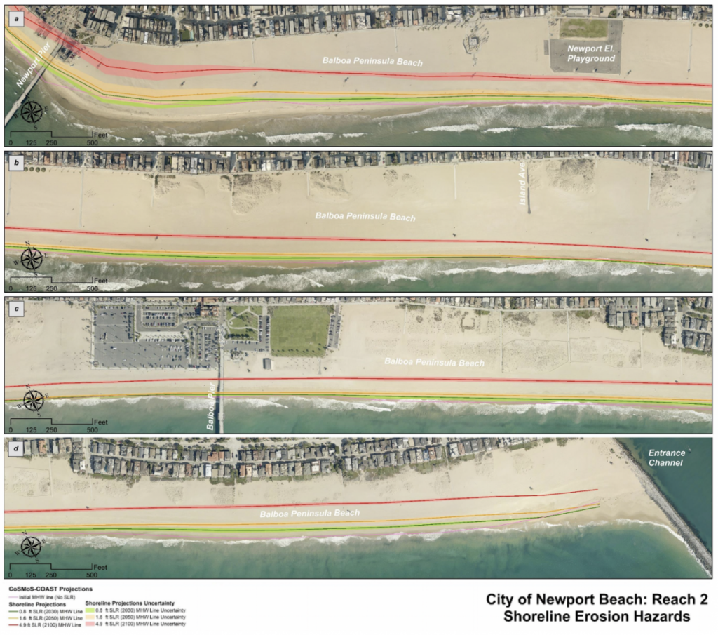
In 2018, the City completed a $1.3 million project to add a 9-inch “cap” to the top of the Balboa Sea Wall to prevent overtopping and further protect against coastal flooding. However, the Coastal Storm Modeling Software (CoSMoS), published by the United States Geological Survey, shows a likely increase of 1.6 feet in water level by 2050. Under these predictions, the sea wall will hold off storm surge for only a few years, and a more long term solution will likely be needed. The City of Newport Beach Sea Level Rise Vulnerability Assessment outlines possible approaches to sea level rise, including a “hold- the- line” strategy of protection, versus a managed retreat approach.

Source: City of Newport Beach Sea Level Rise Vulnerability Assessment
Balboa is facing similar issues as faced by coastal cities all across Southern California on how to adapt to sea level rise and extreme events. Recently, a regional effort led by USC Sea Grant called AdaptLA has allowed cities and organizations to communicate and collaborate on adapting to these challenges. AdaptLA is a network between scientists and local coastal jurisdictions that strives to establish a community of practice by engaging collaboration and increasing the use of the best available science in planning efforts. Municipalities like Balboa are able to share adaptation efforts while tapping into the network and resources of AdaptLA to collaborate with others that may be facing similar challenges.
As severe storms and sea level rise continue to affect the coast and threaten public infrastructure, residential areas, and coastal access, there are opportunities for cities to increase the integration of climate change considerations into their existing planning mechanisms and evaluate potential strategies for furthering adaptation along the coast. Just as the Balboa Peninsula has analyzed and addressed climate vulnerabilities throughout the last century, efforts will continue to protect their valuable coastal city as they continue to experience changing conditions. Even during a time of increasing storm strength and vulnerability, through this continued effort, along with regional collaboration, adaptation to sea level rise in Southern California is not as daunting a task as it may once have been.