
Birds-eye view of the Amazon Rainforest landscape left behind by artisanal-scale gold mining in the MDD, a mosaic of sandy tailings and abandoned ponds. (Photo: Center for Amazonian Scientific Innovation)
The Weight of Gold: Peruvian Forests Pay a Hidden Price for Artisanal-Scale Mining
The Amazon is the largest tropical rainforest and drainage basin in the world, home to a tenth of global biodiversity. Here, ecology and hydrology are inextricably linked; the forest recycles around 40% of precipitation via evapotranspiration, storing and returning a large share of the seasonal rains that keep its ecosystems running and rivers flowing.
This self-sustaining loop has kept the Amazon’s lush mosaic of vegetation historically resilient to deforestation and drought, promoting regrowth and productivity even during dry periods. But decades of unsustainable land-use practices and climate change have worn this resilience thin. And nowhere is that wear more visible than the Madre de Dios region of southeastern Peru, where artisanal and small-scale gold mining (ASGM) has become a major driver of local deforestation.
This distinctly invasive style of mining begins by clearing large swaths of old-growth trees, then, high-pressure water cannons are used to wash away the nutrient-rich topsoil into surrounding forest and waterbodies. Whatever gold is left in the underlying alluvial sediment gets extracted with mercury, an element known for its ability to readily bind to precious metals and its environmental toxicity.
The resulting landscape is jarring, akin to a beach dropped in the middle of the rainforest. Coarse sands where towering foliage once stood. Sediment-laden settling ponds scattered throughout like oases, ridden with mercury from the amalgamation process. If you’re ever en route to the nearby city of Puerto Maldonado, you can actually see this from the plane window, pale gashes fracturing a blanket of verdant canopy that should be unbroken.
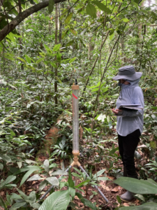
My first foray into researching this system focused on these “gashes”. Specifically, why they struggle to grow anything back, even years after mining stops. Turns out it’s not for lack of water coming in, the sands actually let rain infiltrate faster than in undisturbed soils. The problem is what happens after: with no leafy umbrella left to shade the ground, near-surface temperatures spike, and water evaporates out before it can settle into usable subsurface storage or reach roots. Minimal accumulation, minimal water for plants to draw on, and minimal revegetation.
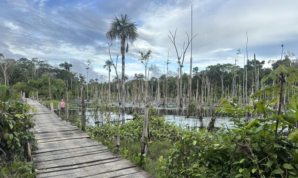
However, in the midst of fieldwork I began to suspect that this wasn’t the full story. For context, accessing these post-mining sites involved many preceding hours of bumpy ATV driving through the primary forest. Near the end of this journey, the route crosses a handful of rickety wooden boardwalks surrounded by dilapidated tree trunks, standing branchless in murky water. These patches of forest had never been mined, but they were dying anyway.
Each subsequent ride made it clearer: vegetation drowning in water where there shouldn’t be any, canopy thinning at mining edges that no chainsaw had ever touched. I became interested in how widespread this phenomenon was, but driving through the entirety of the Peruvian Amazon would be impossible. The good news is that with remote sensing, however, I didn’t have to! My work now aims to catalog these subtler forest losses using pictures taken from space.
In fact, most current ASGM mapping efforts also use satellite imagery, but prioritize acute changes. This does a great job pinpointing new mining activity, but doesn’t address the adjacent forests slowly losing structure and health. This gap is what I have spent the summer trying to fill, by separating degradation (loss of tree cover without conversion to non-forest) from deforestation (conversion from forest to non-forest).
To do this, I’m using a Google Earth Engine algorithm called CCDC-SMA (Continuous Change Detection and Classification-Spectral Mixture Analysis), which combs over decades of regional satellite imagery divided into millions of small pixels, and flags any minor changes in greenness and canopy condition within those pixels. So far, I’ve found that of the 111,800 hectares (~200 football fields) of mining-related forest loss in the past 25 years, only about 65% was directly deforested. The other 35%? Degraded forest, still “intact”, but steadily losing ground because of what’s happening nearby.
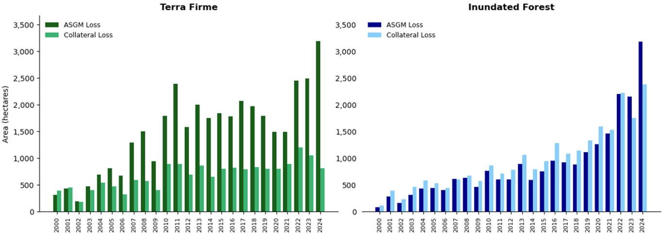
There’s an emerging pattern splitting those two categories that circles back to hydrology, originating from the fact that the Amazon isn’t composed of one single forest type. Some of it is dry, well-drained forest (terra firme); some of it is flood-adapted, inundated forest. My results show that most of the deforestation to date has happened in dry forests, but degradation is disproportionately worse in the wetlands, where connected waterways let byproducts travel and spread. As ASGM begins to migrate into less-mined wetland forests, understanding this distinction matters more than ever. My next goal is to better assess the variables that drive it, from plant type to hydroclimate.
Shreya Ramesh is supported by the USC Dornsife Wrigley Institute Graduate Fellowship.