A collaboration of scientists, managers, and Indigenous Nations assess intertidal sea level rise vulnerability
Located at the land-sea interface, rocky intertidal ecosystems are particularly vulnerable to sea-level rise (SLR). However, little is known about how SLR will affect habitat availability and community structure. These ecosystems also have immense traditional and cultural importance to the Indigenous Nations of California. University of Southern California (USC) Sea Grant funded the Tribal Intertidal Digital Ecological Surveys (TIDES) Project—an interdisciplinary collaboration between academics, marine resource managers, the Tolowa Dee-ni’ Nation, and the Tribal Marine Stewards Network (TMSN)—to assess SLR vulnerability at ecologically, economically, and culturally significant sites in California. The project aims to produce robust SLR vulnerability data while empowering historically marginalized Indigenous Nations to utilize cutting-edge technology.
Key Results:
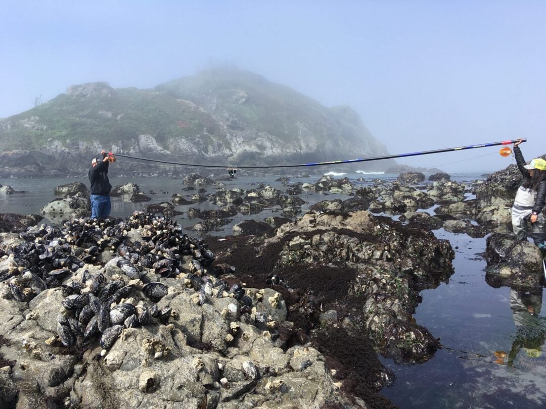
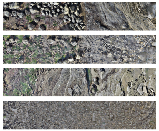
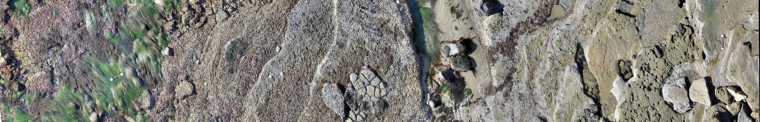
- Collected thousands of aerial images that are stitched together via photogrammetry to build a 3D habitat map capturing a snapshot in time of the monitored area.
- Measured seasonal and annual changes in abundance or distribution for culturally and ecologically important species, allowing for more accurate predictions of how intertidal communities will change under existing sea level rise scenarios and improving adaptive management strategies for coastal resource managers throughout California.
- The TIDES project has contributed to building local capacity for Indigenous nations to lead monitoring and conservation efforts in their territories. The TIDES project is being implemented as part of the stewardship portfolio of the Tribal Marine Stewards Network, and outcomes are being incorporated into the adaptive management plans for each Tribal Government partner.
Project Impacts & Application:
- Published a website and Storymap to share ongoing results with the public
- TIDES Project has been selected as the main monitoring program of the Tribal Marine Stewards Network, the first Indigenous-led marine monitoring program in California
- Numerous trainings were held up and down the coast to share findings and train and engage indigenous youth
Principal Investigators:
- Jennifer Smith, Ph.D., University of California San Diego
- Sarah Giddings, Ph.D., University of California San Diego
Funding:
California Ocean Protection Council, 2018-2021
Additional Info:
- https://tides.ucsd.edu/
- https://coralreefecology.ucsd.edu/tribal-intertidal-digital-ecological-surveys-tides/
- https://storymaps.arcgis.com/stories/870aab4a4b554c1b8814137c622a9479
Access our Publications Database to view publications from this project or other related topics
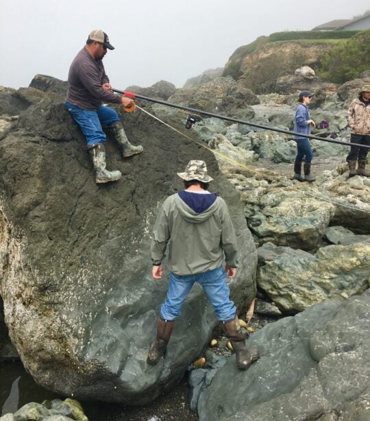
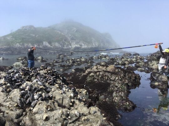
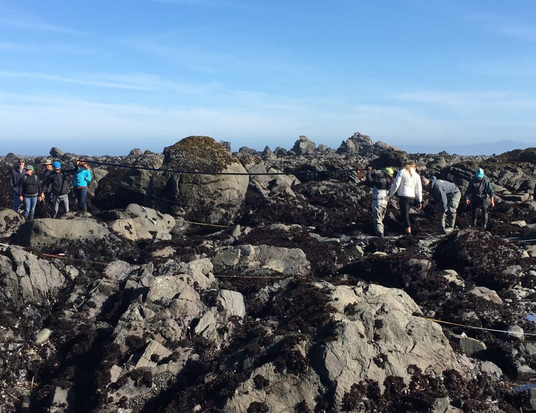
The research team collecting imagery in the rocky intertidal.
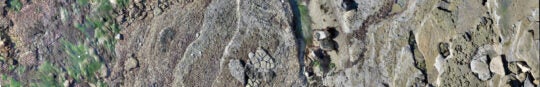
Mosaic image from one of the TIDES sites in Cabrillo National Monument.
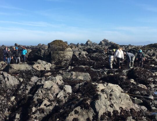
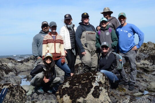
The TIDES team surveying complex intertidal habitat in Smith River.

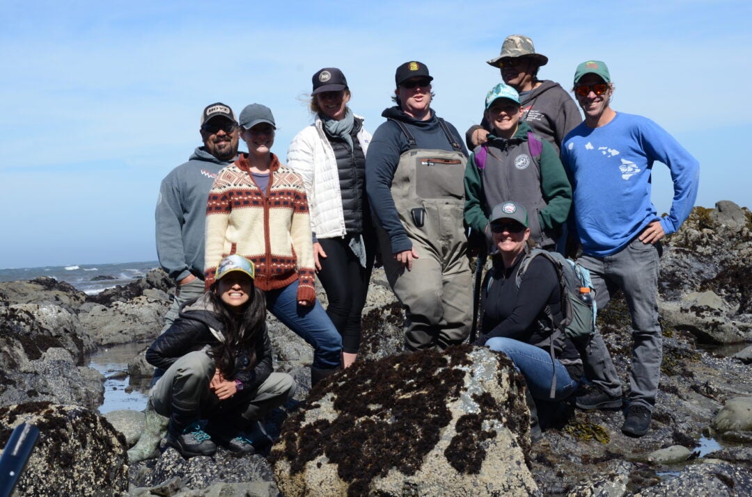
The TIDES team surveying in Smith River.
Large-area imaging survey conducted by Tolowa Dee-ni’ Nation staff.