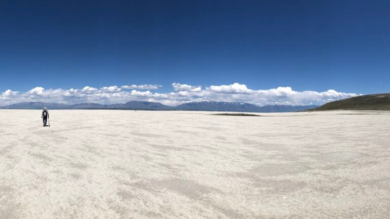
Exposed lakebed of Great Salt Lake. Photo taken in May 2022, six months before historically low lake levels were recorded by the Utah Geologic Survey. (Photo courtesy of Rachel So)
Climate of the ice ages: How water availability in the southwestern US has changed over geological time
Water is one of the essential resources for life. On land, the freshwater sources we rely on– rivers, lakes, glaciers– ultimately originate from falling precipitation driven by Earth’s water cycle. While water availability varies in different parts of the world, water availability for the whole world has also changed over geologic time. What is today a dry desert, might once have been a tropical rainforest. Here in the drought-prone southwestern US, we tend to worry about water a lot, mostly in the form of the question, “Do we have enough of it?” With recent droughts compounded by the threat of anthropogenic climate change, this concern is only growing. Local communities have already experienced the pressure of water shortages and the environmental problems associated with water overuse. A more famous example is the redirection of the Owens River in the early 1900s to supply Los Angeles with water. This led to the eventual drying of down-river Owens Lake and the exposed lakebed became a major source of dust pollution to surrounding communities.
Since water seems to be a perpetual concern in the southwestern US, it may seem surprising that the climate here wasn’t always this dry. In fact, during the last ice age, this region was much wetter. It was so wet that there were several large, freshwater lakes, some of them rivaling the sizes of the present-day Great Lakes. Perhaps the most well-known is Lake Bonneville, a 300-m deep lake that is known today as Great Salt Lake (UT). Great Salt Lake is a hypersaline remnant lake that formed when the massive Lake Bonneville shrunk at the end of the last ice age. It is over 5 times saltier than the ocean and is one of Utah’s main environmental resources supporting various industries. However, like many lakes in the area, Great Salt Lake is at risk of completely drying up due to water diversions for human consumption combined with worsening droughts driven by climate change.
In the southwestern US, much of the water we rely on, both surface and groundwater, accumulated during the last ice age when the climate was much wetter. As we’re no longer in an ice age state, we should not expect that the water we’ve used can simply re-accumulate. Understanding how climate changed over, not just the last ice age, but the last few successive ice ages (which we call glacial-interglacial cycles) will establish a baseline for natural climate variation that we can compare against for future climate change. The goal is also to better understand how both the lakes and the climate changed when the world warmed as ice ages ended.
This is where I come in. As a paleoclimatologist, I study how climate has changed in Earth’s history. While modern climate change is caused by humans, climate has historically changed independent of human activities. The successive ice ages of the last million years is just one example. Evidence of Earth’s climate history is preserved in the geological archives which scientists have many ways to uncover. The way I study past climate is by using lipid biomarkers– compounds made by organisms in response to environmental conditions. These biomarkers are preserved in sediments accumulated at the bottoms of lakes. Different types of lipid biomarkers are made in different climates (e.g., warm vs. cold, dry vs. wet, etc.) so by identifying what types of biomarkers are found in sediments deposited at different times, I can infer what the climate at that time was like.
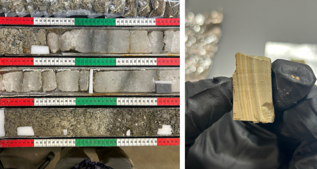
My current research uses biomarkers preserved in the sediments of Great Salt Lake and nearby Bear Lake to study how climate in these regions has changed over the glacial-interglacial cycles of the last 200,000 years. I analyze sediment from cores drilled from the lakebed of the two lakes. These cores are basically tubes of mud taken from the lakebed where mud deposited in recent times is near the top while the mud deposited in older times is buried deeper. By measuring biomarkers in the whole core, I generate a climate record for the lake in the time period when the sediment was deposited.
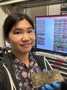
This summer, I visited the Continental Scientific Drilling Facility (CSD) at the University of Minnesota where lake cores from several past drilling expeditions are stored, including the cores from my two lakes. I focused on getting samples from the Great Salt Lake core, as I had already done so for the Bear Lake core 2 years prior. The Wrigley Institute Graduate Fellowship along with a CSD travel grant helped fund my stay at the facility. This is a truly wonderful opportunity for me to physically handle the cores myself and observe the mineralogical changes in the core. Furthermore, a small set of these samples will be radiometrically dated using their uranium and thorium content. While measuring biomarkers is important, knowing when the sediment the biomarkers came from was deposited is just as important. I’m currently processing these samples at David McGee’s lab at the Massachusetts Institute of Technology. By autumn, I will be able to combine both my biomarker results and sediment ages to reveal a Great Salt Lake climate record spanning 280,000 years, encompassing nearly 3 successive ice ages. Alongside my Bear Lake work from last year, I aim to integrate information from both lakes, isolate the climate signal from the noise, and help build a more complete understanding of regional climate. More importantly, I hope my findings will provide helpful insight as present-day climate change progresses.
Rachel So is supported by the USC Dornsife Wrigley Institute Graduate Fellowship.