Catch a virtual bird’s-eye view of climate change at Santa Monica Pier
If climate change patterns hold, the “World Famous Santa Monica Pier” might begin to resemble the lost city of Atlantis in just 30 years. But why tell about it when you can show it?
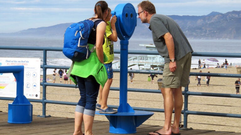
That’s precisely what USC, in partnership with the U.S. Geological Survey and the city of Santa Monica, have begun with the formal launch of a virtual reality installation called “the Owl” at the Santa Monica Pier.
From Nov. 16 through Dec. 31, beachgoers can be immersed in the shore’s submerged future. Through the viewer, they will witness in the blink of an eye a century’s worth of sea rise advancing on the shore, with a 180-degree view of affected areas precise to their location.
“While we can’t stop the inexorable changes to our beaches, we do have cutting-edge science that helps us plan today and adapt to the future,” said Phyllis Grifman, associate director at USC Sea Grant, based at USC Dornsife. “It’s important to have a community-based discussion about how to adapt, and the Owl helps start this conversation.”
180-degree view of the future
The installation resembles the coin-operated binoculars regularly seen at beach piers but with a view of the future where all of Santa Monica Beach, even its parking lot, is drowned under the rising tide. Users can look anywhere within a 180-degree perspective, from ocean to shore, and witness total flooding by the end of the century, wrought by a combination of both sea level rise and changing weather patterns.
The virtual experience was created with scientific models developed by the U.S. Geological Survey, which projects that sea level rise in Southern California will match global projections, increasing 5 to 24 inches in the decades from 2000 to 2050 and anywhere from an additional 12 to 38 inches from 2050 to 2100.
“The Owl is an innovative way for people to see how sea level rise will change the Santa Monica coastline,” said Alyssa Newton Mann, a research, policy and planning specialist at USC Sea Grant. “Rather than looking at flood maps, these photo-realistic visuals put you at the scene of the flood.”
Fighting on against the planet’s greatest threat

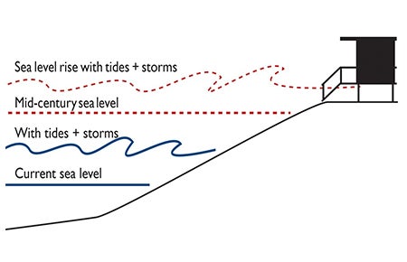
Scientists predict that sea level rise, tides and coastal storms will join forces for the duration of the century to exponentially hasten naturally occurring erosion and beach loss. Coastal Flooding graphic courtesy of Climate Education Partners and adapted by the city of Santa Monica.
USC Sea Grant, in tandem with the U.S. Geological Survey and city of Santa Monica, has provided funding for the project, and USC Sea Grant provided scientific support for the visuals and presentation script, including an interactive quiz about sea level rise.
Sea Grant is devoted to funding research and developing outreach and education products to understand the fundamental threat to the entire planet presented by climate change, and especially its impact on the biology and chemistry of the ocean. Climate change is among the intractable problems that are the focus of study by USC researchers across multiple disciplines.
As part of its work, Sea Grant also works with local and state governments to help coastal managers adapt to the potentially destructive effects of climate change. For this project, the information gathered from visitors to the pier installation will assist Santa Monica planners gauge levels of public concern about sea level rise and assess opinions on natural options, such as sand dunes, to protect the shoreline.
“The Owl” itself was originally developed as a construction virtual reality viewfinder by the Owlized company. It has been in use in Marin and San Mateo counties. USC Sea Grant hopes to continue to further this experience by adding similar installations at other locations along the Southern California coast as well after the Santa Monica Pier installation closes this year.
Those who cannot personally visit the pier in the next few months can see the presentation online and via smart phone at http://mobileowl.co/samo.