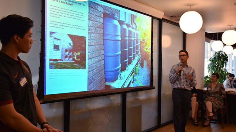
Geodesign majors Austin Chow, left, and Richard Windisch present “Water You Doing?” to about 80 representatives from the City of Los Angeles, nonprofit environmental organizations and business leaders on June 13 at WeWork Gas Tower in downtown L.A. The presentation describes ideas for promoting the capture of rainfall as part of L.A. Mayor Eric Garcetti’s storm water capture initiative aimed at combating drought conditions.
According to the National Integrated Drought Information System, Southern California remains under moderate to extreme drought conditions, despite an increase in the state’s precipitation in 2017 and earlier this year.
Windisch and Chow were part of the Esri Student Research Team, which included their fellow geodesign major Haoshi Joanna Wang and Beau McDonald, project specialist with USC Dornsife’s Spatial Sciences Institute (SSI). The team chose the concept of using rain barrels and cisterns as a straight-forward and accessible way to promote the benefits of storm-water capture to residents of single-family homes and low-density housing.
“At USC Spatial [Sciences], we emphasize that our research teams are interdisciplinary collaborations designed to allow faculty, postdocs, visiting scholars, staff, and graduate and undergraduate students to conduct primary research as equal partners — and we mean it,” said MacDonald.
The team used a geospatial visualization app called “Story Maps,” created by geographic information system software supplier Esri. The app combines maps with data, narrative text, images and multimedia content.
Sari Ladin-Sienne, L.A. Mayor Eric Garcetti’s chief data officer, complimented the great relationship between the Mayor’s data team, the USC Spatial Sciences Institute and students. “We continue to be so impressed by the dedication, knowledge and skill-level [the students] provide,” she said.
The “Water You Doing?” story map presentation is available on the City of Los Angeles’ GeoHub, an open platform that allows the public to explore, visualize and download location-based data.