
New master’s in spatial sciences focuses on big data
It’s difficult to refute: Big data is revolutionizing all industries, from health care and security to environmental sustainability and transportation. As companies grapple with the challenges and anticipate the opportunities that come with this new reality, there’s a growing demand for professionals who are up to the challenge of solving large-scale, data-intensive issues.
To wit, the Harvard Business Review has declared data scientist as “the sexiest job of the 21st century.”
Now, a new joint master’s program at USC Dornsife and USC Viterbi School of Engineering — the very first program of its kind in the United States — offers an interdisciplinary curriculum focused on engineering, computer science, math and spatial sciences principles that will address the challenges inherent in today’s vast location-based data environments.
The program will train students from the disciplines of social sciences and computer science to navigate the field of data analytics and understand how spatial informatics skills can benefit forward-thinking companies. They learn how spatial data management, data visualization, and artificial intelligence techniques like data mining and machine learning are powerful analytical tools to apply to real-world challenges.
John Wilson, director of USC Dornsife’s Spatial Sciences Institute (SSI), and Cyrus Shahabi, director of the informatics program at USC Viterbi, are the program’s co-directors. Craig Knoblock, a computer scientist with joint appointments at SSI and USC Viterbi, and Susan Kamei, associate director for SSI, are associate directors of the program. The degree curriculum was approved in May and its first cohort of students began coursework this Fall.

John Wilson, director of USC Dornsife’s Spatial Sciences Institute, and professor of sociology, civil and environmental engineering, computer science and architecture. Photo by Peter Zhaoyu Zhou.
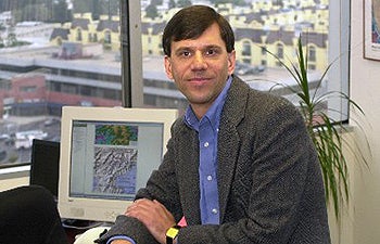
“The new spatial informatics program is important because it bridges the gap between the big data technologies becoming available and the spatial sciences, where these technologies are very relevant and can be applied to solve real-world spatial data problems,” Knoblock said. “It is unique in that it’s the first informatics program that is directly focused on spatial data and big-data technologies.”
Bridging disciplines
Today, students are trained in either computer science or geographic information systems — very rarely in both. However, Knoblock said, what companies need and want as they are trying to address geographic data challenges are people that know the computer science side and have a background in spatial data.
While companies have long used both open-source and proprietary software tools to solve problems and implement new ideas, Wilson believes that in the future it will be less about companies using software out of a box and more about software as a service. The rise of cloud computing — using a network of remote servers hosted on the Internet to store, manage and process data — is an indication of the direction we’re headed. Data sets will become integral forms of business intelligence, he said.
At the same time there is a big push toward customization, which is achieved through computer coding. A classic example is the Google Maps application that allows users, while drawing from one massive geographic database, to customize their query results to generate a route that avoids freeway tolls or uses public transportation or bike routes exclusively.
“This is the future — in all kinds of businesses and governments, people are going to want to do this kind of customization in a very dynamic way,” Wilson said. “They’ll want apps for mobile phones and standard forms to query databases in specific ways.
“In spatial sciences, which is a bridge discipline, if we want to be in the business of helping to teach tomorrow’s work force to do these things, people are going to need some fundamental computer science skills as well as spatial science skills. This degree is a way to do that.”
Craig Knoblock, director of Information Integration Group and research professor of computer science and spatial sciences.
As associate director of data informatics at USC Viterbi, Knoblock helps to identify new areas where a joint degree program can fill an academic gap.
“Since I already work on both computer science and spatial sciences, I could immediately see there was a great opportunity here and USC could become the leader in spatial informatics,” he said.
“Our goal was to build partnerships with other units on campus so we can be first-rate in everything we do,” Wilson added. “At USC we have the advantage of a collection of faculty at the top of their game, and we have a track record of success in both areas. So we’re working together to build a synergy where the whole is greater than the sum of the parts.”
The perfect combination
Nandan Nayak is one of the program’s first students. In India he received a bachelor’s degree in engineering and had been working as a senior software engineer. After gaining adequate experienced in coding he was interested in working on the application side, doing things like data mining and analysis.
“I’m optimistic about this program as it combines data informatics and spatial sciences,” he said. ”Both areas are unique, and job candidates with this combination of technical knowledge are highly sought after.”
Nayak said he has enjoyed learning new software tools such as SAS, ArcGIS and CityEngine, which facilitate data analysis and coding for 3-D models.
Another student, Yuqing Qian, hails from China and is an experienced coder with a bachelor’s degree in management information systems. She was drawn to the degree program because of its small class size and the growing importance of geographic information science.
“It can be applied to many areas, such as the economy, business and the environment. It’s a new interdisciplinary area and I think it is very useful. What I am learning in this program will benefit me well in the future.”
Wilson said that potential employers for graduates includecompanies like Esri, Google or Microsoft, the utility and business sectors, as well as federal, state and local governments that are currently trying to open up their data and use it to provide useful services for their residents.
“I’m confident that for our existing programs and this new one, future job growth will be quite substantial,” Wilson said. “Reports from the federal government suggest that, as well.”