Career and Graduate School Opportunities
Global Geodesign alumni have gone on to graduate studies and careers in environmental sciences, geodesign, geographic information science, landscape architecture, spatial planning, sustainability management and other related disciplines.
Geospatial and geodesign jobs currently are available and growing in every industry and discipline in consulting firms, non-profit organizations, government agencies, and private-sector companies.
Read about the international conference GEOBIM, that brings together experts and practitioners in geodesign, construction management, geospatial technologies and more.
Esri presents a Geodesign Summit each spring at its Redlands, California headquarters. Geodesign thought leaders and practitioners from around the world gather to share inspiration and insights on healing our planet for a more sustainable future.

Gain comparative global experiences with SSCI 350: International Geodesign
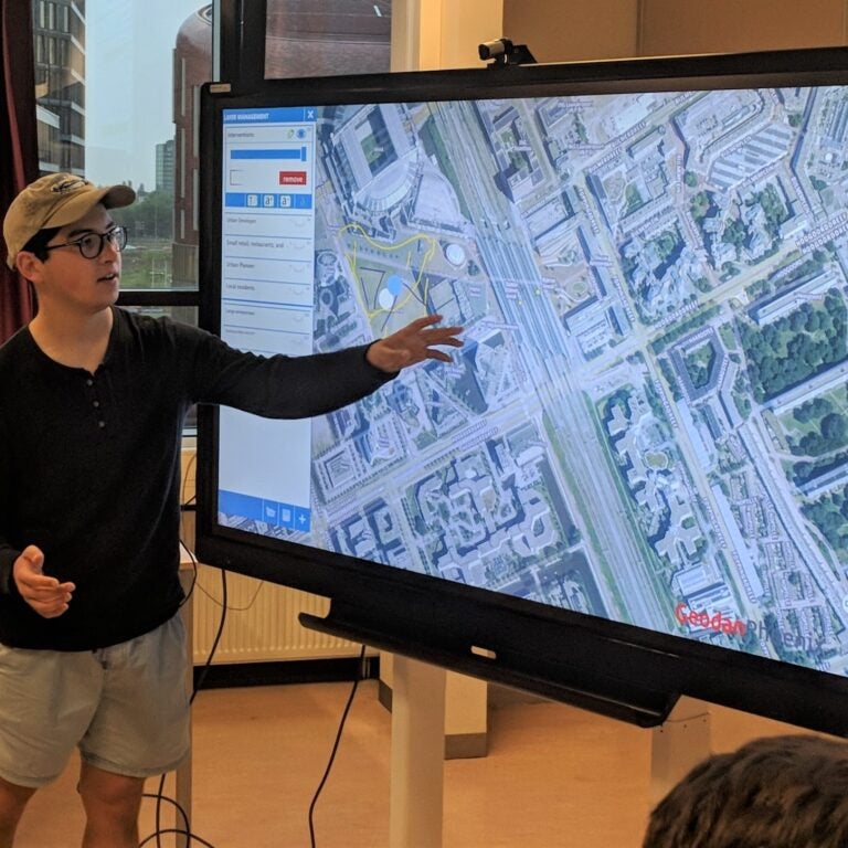
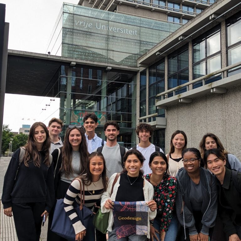
In the Spatial Sciences Institute Maymester course SSCI 350: International Geodesign, any USC undergraduate can intensively learn and apply interdisciplinary geodesign principles and practices in a global context.
By participating in two or more International Geodesign courses, you can gain a truly global perspective through the comparison of governmental, sociopolitical, environmental and historical contexts in different parts of the world.
Past locations have included Amsterdam, Rotterdam and Salzburg, and upcoming locations include Accra and Winneba, Ghana. Planning for future locations is in the works for South American and Asia.
SSCI 350 was one of my favorite classes I’ve taken at USC and one of my most memorable experiences.

Learning Objectives
-
Graduates will have achieved:
- a deep understanding of:
- the myriad ways in which places can be constructed, interpreted, and experienced by different people;
- the principles of design and how these can be used as a force for good in building healthy, livable, and sustainable communities;
- how urban and regional planning provides a framework for promoting civic engagement and collective action;
- how geographically referenced data can be gathered and organized to support a large number and variety of collaborative projects;
- how geospatial data can be analyzed, modeled, and visualized to inform design and planning, and by doing so, support public participation and urban development; and
- how form and function co-exist and evolve in urban and rural settings and how globalization connects near and far-away places and actions;
- an understanding of the broader context in which the research issues of geodesign are positioned; and
- a breadth of knowledge, as demonstrated by a general knowledge of the physical and natural world, a general knowledge of world histories, philosophical traditions, major religions, and cultural life worlds and an understanding of economic forces and political dynamics.
- a deep understanding of:
-
Graduates will have:
- highly developed cognitive, analytic, and problem-solving skills;
- the capacity for independent critical thought, rational inquiry, and self-directed learning;
- the ability to work, independently and collaboratively, on research projects that require the integration of knowledge with skills in analysis, discovery, problem-solving, and communication;
- mathematical skills;
- familiarity with the general scientific method;
- second-language competence;
- the ability to engage with socio-cultural frameworks and tradition other than their own; and
- the ability to plan work and to use time effectively.
-
Graduates will demonstrate interdisciplinary skills, i.e., they will:
- be able to evaluate which disciplines are involved in the solution of complex issues;
- be able to assess which research methods are most suitable in a particular situation;
- be able to integrate the content and research methods from architecture, urban and regional planning, spatial sciences, and other disciplines relevant to a particular situation;
- be able to defend a well-considered viewpoint covering the relevant disciplines; and
- know which phenomena are being studied in different disciplines and which research methods and theories are used.
-
Graduates will possess the attitudes as well as skills for lifelong learning, i.e., they:
- know how to obtain and evaluate information; and
- are able to orient themselves on a new knowledge domain, formulate an overview, and determine their knowledge gaps.
-
Graduates will demonstrate excellent communication skills, i.e., they will be able to:
- express themselves well verbally and at an academic level in writing;
- present ideas in a clear and effective way; and
- communicate knowledge to a public consisting of specialists or laypersons, making use of various modes of communication.
-
Graduates will be able to demonstrate engagement at local, regional and global levels, i.e., they will be able to:
- use a knowledge of cultures in explaining current problems in society;
- understand and appreciate cultural differences, not only at a distance, but in real life;
- live with different value systems in daily life, and reflect on their own value systems; and
- demonstrate an international awareness and openness to the world, based on understanding and appreciation of social and cultural diversity and respect for individual human rights and dignity.
-
Graduates will be able to demonstrate:
- profound respect for truth and intellectual integrity, and for the ethics of scholarship;
- intellectual curiosity and creativity, including understanding of the philosophical and methodological bases of research activity;
- an openness to new ideas and unconventional critiques of received wisdom; and
- leadership skills, including a willingness to engage in constructive public discourse, to accept social and civic responsibilities and to speak out against prejudice, injustice and the abuse of power.
CURRICULUM
The B.S. in Global Geodesign is a highly structured academic program that requires a minimum of 128 units.
The Global Geodesign curriculum satisfies the requirements of USC general education, writing, diversity and USC Dornsife majors.
MAJOR REQUIREMENTS
-
Behavior of firms and consumers, functions of the price system, competition and monopoly, labor markets, poverty, government regulation, international trade, and the environment.
-
An introduction to the basic tools of statistics. Descriptive statistics; probability; expected value; normal approximation sampling; chance models; tests of significance.
-
Conceptual foundations and techniques of statistics and how they can be used with geographic data to produce actionable information across spatial science domains.
CORE COURSES
-
Foundations of geodesign combining place-making, design, collective action, and the science of location-based information to improve human interaction with the functioning of the Earth.
ARCHITECTURE SEQUENCE
-
Methods for direct observation and recording of the directly experienced built environment through drawing, diagramming, photographing, and writing. The course includes exercises and field experience.
-
Introduction to design principles and processes; sequence of exercises emphasizing the development of basic skills, ideas, and techniques used in the creation of simplified urban space design projects. Prerequisite: ARCH 203.
-
Emphasis on developing advanced urban spatial design solutions set within contemporary urban conditions, with a particular emphasis on ecology, public space, neighborhoods and districts. Prerequisite: ARCH 303.
PLANNING SEQUENCE
-
Gateway to B.S., Public Policy, Management and Planning and minor in Planning and Development. City building and development process; who plans; politics of planning and development; major topics include land use, fiscal policy, transportation, sustainability, and economic development.
-
Historical evolution of planning and development. How changing modes of planning and development have shaped the built landscape throughout the century.
-
Theories and concepts of livable communities and good city form; case studies of historical and current best practices; field visits; collaborative design project.
SPATIAL SCIENCES SEQUENCE
-
Role of maps and spatial reasoning in the production and use of geographic information for representing and analyzing human and environmental activities and events.
-
The various ways in which geography can be used to acquire, represent, organize, analyze, model and visualize information. Laboratories are organized around ArcGIS software suite. Prerequisite: SSCI 301L.
-
Fundamentals of spatial modeling and remote sensing and how to use GIS customization and programming to streamline complex spatial analysis and modeling workflows. Syllabus. Prerequisites: SSCI 301 and SSCI 382.
GLOBAL GEODESIGN SEQUENCE
-
A world-wide perspective of architectural history as a product of social, cultural, religious, and political dimensions, 4500 BCE to 1500 CE.
-
Concepts, practices and contexts of public engagement and their importance to the geodesign process. Recommended Preparation: SSCI 201
-
Use of sustainability theory and practice to compare various geodesign practices; application to specific locations around the world to promote a sustainable global environment. Recommended Preparation: SSCI 201
-
Intensive living-learning research and field experience in Los Angeles and abroad; application of geodesign strategies to local societal challenges.
CAPSTONE COURSE
-
Application of design concepts, planning protocols and spatial analysis skills to a complex planning or design problem sponsored by a local public, private or not-for-profit client in a studio setting.
Learn more
-
Talk with Dr. Diana Ter-Ghazaryan, Director of Undergraduate Studies, Spatial Sciences Institute, about the advantages of being a Global Geodesign major or adding Global Geodesign as a double-major. E-mail her or call her at (213) 821-1190.
-
Candidates for the B.S. in Global Geodesign can qualify for graduation with departmental honors:
Eligibility requirements
Geodesign majors with cumulative GPA ≥ 3.7 in department courses in their second to last semester and an overall GPA ≥ 3.5.
In addition, to qualify for the honors designation, Geodesign majors must complete one or both of the criteria listed below:
- Students present a poster or make a presentation of their research at a venue such as the Provost’s Undergraduate Research Symposium, the Los Angeles Geospatial Summit, or another professional conference; and/or
- Students exhibit leadership within a club or organization (e.g., SC Mappers), serve as a speaker for an academic event (e.g., GeoDesign Speaker Series), or represent the B.S. in Geodesign program in some effective way.
Enrollment Process
Eligible and eligible students apply for the Geodesign Honors Program and are enrolled in the Geodesign Honors Program by their academic advisor preceding their final semester.
Honors Application
Students are required to submit to the Geodesign academic advisor an application package that includes the following items: name, student ID, major, GPA (overall and in the department), current and dated resume, STARS report, and proof of participation for distinction of honors. Geodesign majors meeting the GPA and other criteria in their final semester also will be invited to apply in their final semester at the discretion of the Geodesign Honors Program evaluation committee.
Evaluation and Designation of Honors Distinction
A Geodesign Honors Program evaluation committee–comprised of at least one faculty representative from the School of Architecture, Price School of Public Policy, and the Spatial Sciences Institute–will be formed each year by the Spatial Sciences Institute Director of Undergraduate Studies to identify and assess which Geodesign majors will receive the honors designation.
Honors Designation:
There is not a fixed number of honors designations that can be awarded each year.
B.S. in Geodesign students who earn the honors designation will see the designation on their USC transcripts. This honors designation is not printed on diplomas.
-
The USC Progressive Degree Program enables superior USC undergraduates to begin work on a master’s degree while completing requirements for their bachelor’s degree. Students who are admitted to a master’s program with a progressive degree option can complete both their bachelor’s and master’s degrees in five years.
With a progressive degree path, B.S. in Global Geodesign could lead to a:
- M.A. in Environmental Studies
- Master of Planning
- M.S. in Geographic Information Science and Technology
- M.S. in Spatial Data Science
- M.S. in Spatial Economics and Data Analysis
- M.A. in Global Security Studies
A B.S. in Policy, Planning, and Development or a B.S. in Architectural Studies could lead to a:
- M.S. in Geographic Information Science and Technology.
Consult the USC Progressive Degree Program information and discuss specific details about your interests and goals with Monica Pan, SSI academic advisor, at monicap@usc.edu.


