HSGI Projects
Agricultural disruption from Russian invasion
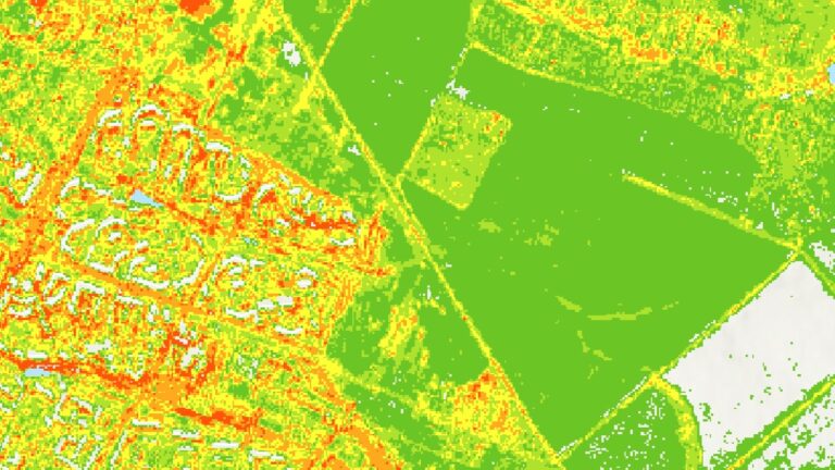
Dr. Darren M. Ruddell and Dr. Yi Qi are examining issues of food security and agricultural activity in Ukraine following the Russian invasion of 2022. The project aims to investigate Ukraine’s agricultural production before and after the Russian invasion by employing a suite of advanced geospatial technologies to detect and quantify agricultural activity and disturbances between February 2022 and August 2023.
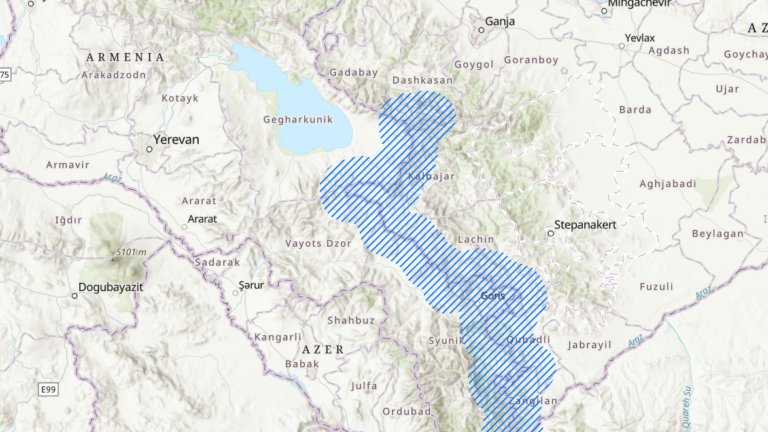
Evolving Borderlands: Security along the Armenian-Azerbaijani border
The Nagorno-Karabakh Conflict, one of Post-Soviet Eurasia’s longest and most bitter “frozen conflicts,” was reactivated in 2020, when a 44-day war broke out between Armenia and Azerbaijan over the self-declared Armenian-backed Republic of Artsakh. The conflict ended abruptly in September 2023, when Azerbaijan seized the territory overnight, after a cruel and grueling blockade of the region.
As a result, what had been a “spongy border” became a “hard international border between unfriendly neighbors” (McGlynn, 2020), which presents significant complications for the local inhabitants who now suddenly find themselves living in the borderlands. Dr. Diana Ter-Ghazaryan’s project uses satellite imagery and geospatial analysis to study the security situation along the border between Armenia and Azerbaijan, and to study the material effects of the very process of “borderization” on the ground.
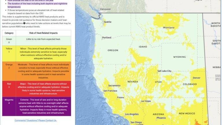
Improving Phoenix’s Extreme Heat Information System
A consortium that includes Dr. Darren M. Ruddell is working with the National Weather Service to develop a heat watch warning tool that sidesteps the problem of warning and false-alarm fatigue and provides more relevant information to people engaged in specific activities on all days of the year, based upon NWS work in Phoenix. The goal of a new HeatRisk tool is to improve human health outcomes based upon meteorological data.
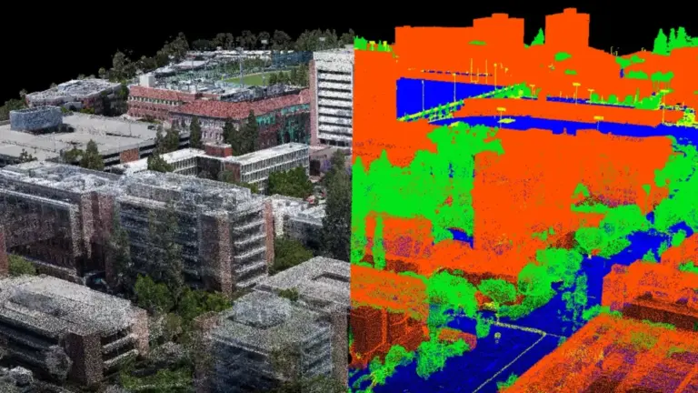
3D World Construction with Drone
Dr. Yi Qi is leading a project (funded by USC Institute for Creative Technologies) focusing on a high-throughput, high-fidelity, automated digital world construction with drone-based remote sensing for human-reality interaction and simulation. This complex effort will converge interdisciplinary approaches including remote sensing, photogrammetry, computer science, computer vision, 3D visualization, and so forth. This cutting-edge project is to support ICT’s One World Terrian mission, which is a pillar of the Army’s Synthetic training Environment.