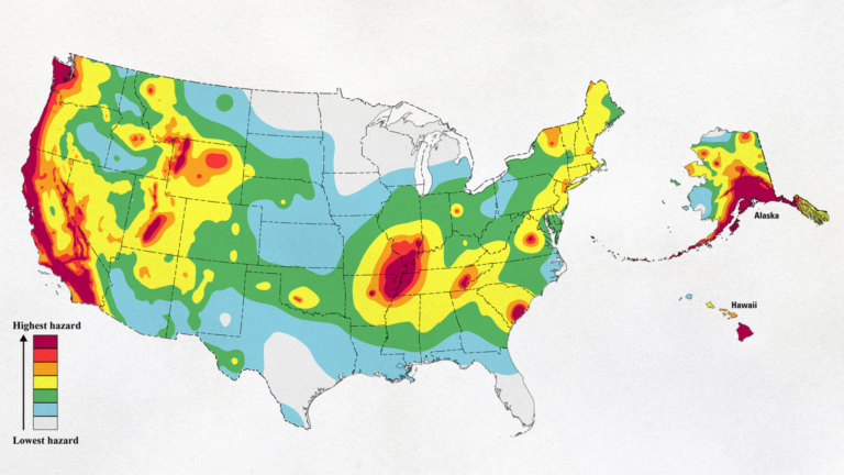
USGS map shows earthquake hazard levels throughout the United States. (Image source: USGS/public domain.)
How threatened by earthquakes are US communities? New report gives answers
Researchers at USC Dornsife’s Statewide California Earthquake Center contributed models that forecast earthquake ruptures for the U.S. Geological Survey’s National Seismic Hazard Model.
When it comes to earthquakes in the United States, California springs to mind as the nation’s hotspot. But the rest of the country is far from immune, as residents in the New York City region were reminded on April 5 by a magnitude 4.8 temblor centered nearby in New Jersey.
Even citizens of the nation’s interior face a threat. Over several months in the early 1800s, for example, numerous earthquakes — some reaching magnitude 7.5 or higher — devastated a massive area radiating from the Mississippi River town of New Madrid, Missouri.