Celebrating innovation: Highlights from the 2025 LA Geospatial Summit ArcGIS StoryMaps Competition
Every year, one of the most popular events at the annual Los Angeles Geospatial Summit is the ArcGIS StoryMaps Competition sponsored by Esri. At this event, undergraduate and graduate students from institutions such as California State University, Long Beach, the University of Redlands, and the University of Southern California showcase their innovative ArcGIS StoryMaps to compete for awards.
“The LA Geospatial Summit, and its annual Esri Storymap competition give us an inspiring glimpse into some of Southern California’s brightest academic stars and our workforce of tomorrow. Esri has a history of hiring Interns, Student Assistantship participants, and even full-time employees from the long list of previous LA Geospatial participants. Previous participants have gone on to significant roles at Esri. We eagerly anticipate this event every year and the opportunity it provides for us to meet our future geospatial colleagues. We value the opportunity to connect with such talented individuals. Thank you for the opportunity to participate in this exciting event each year!” says Andrew Haglund, Esri Higher Education Senior Account Manager.
At the 2025 Los Angeles Geospatial Summit, participants presented a broad range of StoryMaps covering subjects from global mining and tropical cyclones to 15-minute communities and immigration. While all submissions demonstrated creativity and analytical depth, the following three StoryMaps were recognized:
“Most Compelling Communication Using Maps”
Phillippa Burgess
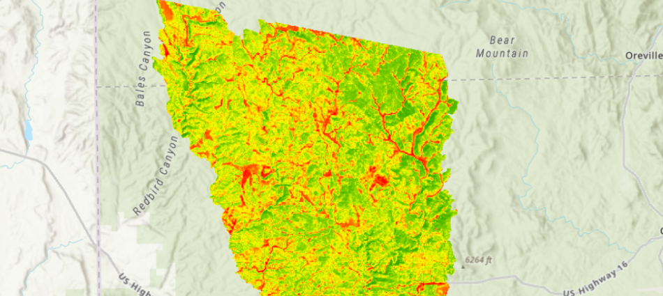
Phillippa Burgess’s StoryMap, Geospatial Insights: Jasper Fire in the Black Hills, investigates the ecological, social, and economic aftermath of South Dakota’s devastating Jasper Fire of 2000. By integrating geospatial analysis and remote sensing, Burgess illustrates 25 years of recovery efforts and the challenges of ecosystem restoration.
“Full forest recovery after a wildfire is not guaranteed—it can take multiple generations, if it happens at all, and requires significant human intervention,” Burgess explains.
Her StoryMap underscores the long-term impact of wildfires and highlights the critical role of geospatial tools in tracking and supporting ecological recovery.
Phillipa holds her GIST Certificate and an M.A. in Urban Planning from the USC Sol Price School of Public Policy. She is also a candidate for an MS in Human Security and Geospatial Intelligence from the USC Spatial Science Institute (expected May 2025) and an MSL (Master of Studies in Law) with a Certificate in Privacy Law and Cybersecurity at USC Gould School of Law (expected May 2026).
“Most Suitably Applied Analysis Methodology”
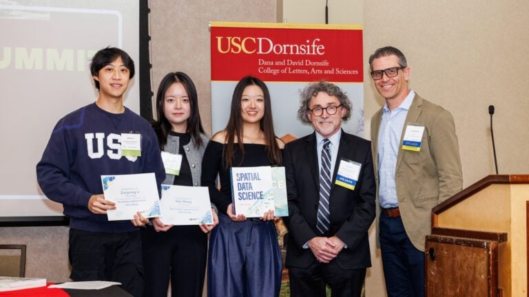
Zixin Huang, Nan Wang, and Zongrong Li
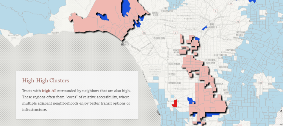
Zixin Huang, Nan Wang, and Zongrong Li’s StoryMap, Transit Triumph or Traffic Tangle? Evaluating Los Angeles’ Transit Equity for the 2028 Car-Free Olympics, assesses the feasibility of a public transit-dependent Olympic Games.
Using the Two-Step Floating Catchment Area (2SFCA) method, the students analyzed accessibility to Olympic venues, incorporating variables such as infrastructure, population density, and socioeconomic disparities.
Their findings reveal significant gaps in accessibility, prompting Zixin to emphasize the need for targeted interventions:
“Microtransit services, multilingual guidance hubs, and barrier-free infrastructure improvements are urgently needed in underserved neighborhoods—broad, citywide solutions won’t be enough.”
Zixin Huang and Nan Wang are both candidates for an M.S. in Spatial Economics and Data Analysis from the USC Spatial Sciences Institute (May 2025). Zongrong Li is a candidate for an M.S. in Spatial Data Science from the USC Spatial Sciences Institute (May 2025).
“Most Innovative Use of Technology”
Yash Kishorbhai Pansheriya
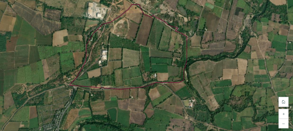
Yash Kishorbhai Pansheriya’s StoryMap, Empowering Mango Farming with AI, investigates how artificial intelligence can accurately diagnose mango diseases and provide farmers with actionable information for timely interventions. This technology is crucial for countries like India, where mango farming plays a major role in the agricultural economy.
Pansheriya evaluated the performance of several AI models—including MobileNet, VGG16, InceptionV3, DenseNet121, AlexNet, ResNet50, and EfficientNetB7—to see if they could accurately diagnose mango diseases through image analysis. His research demonstrates how this technology can enhance food security and improve farming practices.
Despite the complex AI models involved, the tools required are simple and accessible.
“Since it works on mobile devices, even farmers with little technical knowledge can use it easily,” says Pansheriya.
Pansheriya is a candidate for a Master of Science in Computer Science at California State University, Northridge, and is expected to graduate in the spring of 2026.