
Spatial sciences teams take top prizes in hackathon
Two teams of students from USC Dornsife’s Spatial Sciences Institute (SSI) captured top prizes at a recent hackathon presented by the National Geospatial-Intelligence Agency (NGA) in Los Angeles.
The hackathon challenged participants to use geospatial information to better understand, model, visualize and monitor links between food security and regional stability in Morocco. The exercise could help experts understand and predict humanitarian and military crises in the country and other regions of the world.
Judges looked for several key criteria: impact for the target audience and its scalability; creativity and originality; design; and execution.
Students Ishan Alok, Cheng Gu, Joanna Wang, Zhiyuan Wang, and Yu Ru took the grand prize, of $3,000. Their team, “Optimizing Fishery Distribution to Drought Regions,” created a model for the Moroccan fishery industry to visualize the optimal way to distribute fish from major fishing ports to inland populated cities. Morocco is a top African producer of fish, and a country whose agricultural and livestock yields are highly susceptible to frequent drought. The team argued that fish can be a nutritional and stable food supply for areas suffering from shortages.
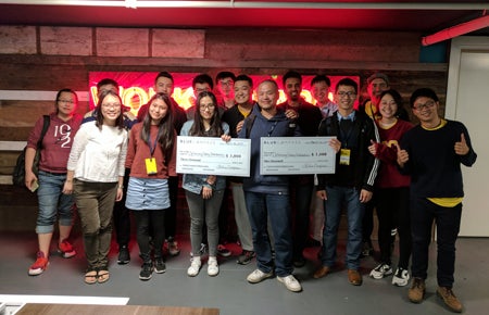
USC Dornsife’s SSI teams took top honors at the hackathon.
Their tool estimated the fish catch from 12 major ports as well as the inland population clusters, and then determined the shortest route between the port and each city. The method used the Road Graph plugin for QGIS, a free and open source geographic information system. The team’s model allocated amounts of fish to each city based on population and visualized delivery routes with animated dots moving inland from the ports.
Team “Happy Farmer,” comprising students Siyu Deng, Haowen Lin, Yijun Lin, Liwei Xia, and Steven Yu, took the $1,000 runner-up prize and a one-year subscription to Jet Brains software for each member. Their web application gives information on farmers’ planting activities by predicting next year’s barley production and consumption and hunger rates across the county. The model also indicates arable land that has not yet been plowed and compares cultivated land data and land type data to find the area and location of arable lands and sort them by reclamation cost for consumers.
“This hackathon presented our USC spatial sciences, computer science, spatial informatics, and data informatics students with a valuable opportunity to gain exposure to NGA’s work in human security and how they can apply their studies to contribute to a ‘wicked world issue’ such as food security,” said Ret. Col. Steven D. Fleming, professor of the practice of spatial sciences at USC Dornsife.
Several students from the winning teams, including geodesign major Joanna Wang, are part of the SSI Spatial Computing Lab. Wang said her education and experience in geographic information science, coding and political science were a boon for her.
“This background knowledge allowed me not only to perform solid spatial analysis, but also to provide substantial research on the issue, while communicating efficiently with the ‘hackers,’ who were crucial to carrying out the ideas.”
Los Angeles Hackathon for Food Security from Blue Compass on Vimeo.
Judges for the hackathon, which took place March 25–26, were Yao-Yi Chiang, assistant professor (research) of spatial sciences; Rebecca Bridgeford, municipal technical liaison; Charlie Chapin, NGA tech scout; Mike Costache, managing partner at Krowdmentor; Chris Kalima, director of product development for Planet OS; and Manuela Rayner, NGA imagery scientist and food security subject matter expert.
The USC Spatial Sciences Institute is designated by the NGA and the United States Geological Survey as a Center for Academic Excellence in Geospatial Sciences. For more information about SSI research and academic initiatives in spatial informatics, spatial computing and digital map processing, spatial analysis and visualization, geospatial intelligence (GEOINT), and geographic information science and technology, please visit spatial.usc.edu or contact Susan Kamei, SSI managing director, at kamei@usc.edu.