
Tracing the history of Argentina’s geologic landscapes
Your alarm wakes you well before sunrise, and it’s cold when you roll out of bed. You’re in the southern hemisphere, Argentina to be exact, and it is winter. You head to where breakfast is being served and eat French bread with dulce de leche, a caramel-like spread that is traditional in the region.
You pack a simple sack lunch and gather your compass, GPS device, field notebook and water — at least two liters of it. Next comes the bus ride, which can take up to two hours depending on which site you’re working at that day. Luckily, the views are spectacular. Once you arrive at your destination, seven to eight hours of hiking across varied terrain while taking measurements and plotting them on a map awaits.
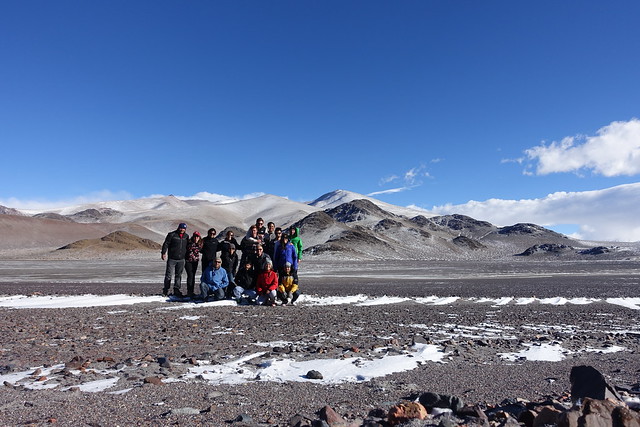
This represents a typical field day for a geologist studying volcanic arcs in Argentina. USC Dornsife students got to experience this life firsthand this summer as part of the Maymester course, “Geological History of the Argentina Andes.” After preparatory coursework at USC, 10 undergraduates and three doctoral students traveled to Argentina for three weeks of hands-on geology research.
Working on two primary sites, they were collecting field data to help them create geologic maps related to the structure of the region. Their home base was a research center in Anillaco, a town of some 1,600 souls in northwestern Argentina known, among other things, for its proximity to a boulder that locals say resembles the profile of Jesus Christ.
Senior Madelina Pratt, originally a biomedical engineering major, recently shifted her focus and enrolled in the progressive master’s degree program in environmental engineering. She said she chose this class “for the joy of learning geology.”
“We had nine field days and we went out to this rugged, untouched terrain,” she said. “It was fun to hike through the beautiful Argentinian countryside and look down at what we were standing on, trying to understand the history of the area and the composition of all the things we were walking across.”
The terrain is indeed rugged, with giant rocks sprinkled over open plains right up to the base of distant mountains that look so magnificent with their muted, earthy colors, it’s almost like a painted background on the set of a play.
SLIDESHOW: Click the link and follow along the group’s adventures in Argentina.
Photos by Tarryn Cawood unless otherwise noted.
A deeper understanding of volcanic systems
Most of the team’s research focused on the approximately 470 million-year-old Famatinian Arc, once a chain of volcanoes that formed above a subduction zone where an oceanic tectonic plate is sliding under a continental one. The interplay of heat, gases and fluids in this dynamic environment literally melts rock, creating magma — melted rock with crystals in it — that eventually moves up through the crust. Sometimes the magma solidifies while it is still deep, forming masses called plutons, and sometimes it emerges at the Earth’s surface in the form of volcanoes.
They studied this underground “plumbing” system of molten rock, from the source deep below the Earth’s crust all the way to the surface. The Argentina sites are ideal because there are different depths of the crust exposed, said Scott Paterson, the professor of Earth sciences who co-led the trip.
At one site you can see the roots of old volcanoes just below the Earth’s surface and the plutonic plumbing systems that were feeding them. At the other site, a deeper plutonic section has been uplifted and exposed so that it is now visible to scientists.
“We want to understand the long-term history and evolution of our planet,” Paterson said. “This helps us learn about past activities, but it also allows us to understand modern systems where volcanoes are forming and erupting.”
Reconstructing the history of these geological landscapes requires hundreds of careful measurements, an abundance of meticulous notes, hours of drafting maps and the collection of dozens of rock samples.
At one site, students took structural measurements of folded rocks, which were once below the sea, to investigate whether collision with a neighboring micro-continent caused the folding.
“We were also treated to spectacular views of more recent geology in the high Andes, like the black lava flows and basalt dome-volcanoes,” said Tarryn Cawood, a Ph.D. student in Earth sciences.
Field days varied in character depending on the elevation and weather conditions. Most days were chilly, and one morning the group worked through a mountain snowstorm, “complete with eerie winter scenery and icicles in our hair,” Cawood said. There was also the sand-blasting wind. On the very first day of mapping, senior Taleen Mahseredjian lost her smart phone when strong gusts blew it out of her backpack pocket. (She never found it.)
The researchers gathered data at elevations ranging from 8,000 to 12,000 feet, and the students hiked up and down many hills and across ridges and flat land. After a day of data collection, the group would reassemble back at home base to examine the day’s findings and plot them on a collective map.
“We’d have all these puzzle pieces and the group would put them together at the end of the day,” said Mahseredjian, a double major in geology and neuroscience. Relatively new to geologic field work, she said she was blown away by how much she learned in three weeks.
The world is your classroom
Paterson’s primary goal for the class was getting students out to do real geology research.
“They get all this class learning, but it’s so different to be out in the real world and have to apply it,” he said. “Watching them grow intellectually when they’re having to use their skills is really rewarding.”
Learning how to work together and function smoothly as a scientific team, as opposed to working independently in a lab, was another important goal for the students. While doing so they also had the opportunity to interact with student scientists from another culture, who spoke a different language, which added an extra layer to the learning experience.
And then there was the place.
“I honestly marveled at the things we saw, the beautiful views and incredible structures,” Pratt said. “[In our academic careers] we don’t have a chance to marvel very often at this incredible world that we live in and the amazing stuff we are learning. In Argentina, we did it on a daily basis.”