Preparing for the Next High Tide
Based in USC Dornsife, the USC Sea Grant program is continuing the work it started three years ago to help coastal communities in Southern California incorporate “resilience” into their planning for adaptation to rising sea levels and climate change.
From San Diego to Santa Barbara, Sea Grant works with researchers and community leaders to help governments, businesses and community groups know the resources available to help them plan ahead.
“We refer to our approach as an ‘adaptive adaptation’ strategy,” said Phyllis Grifman, associate director of USC Sea Grant. “Information about climate change and sea level rise is going to keep changing; there will be new information all the time. That’s important for people to understand so they can start planning now for their communities with confidence. They don’t need to wait for ‘perfect information.’ The idea that this information might be ‘perfect’ at some point in the future can be paralyzing in the present.”
In January 2014, USC Sea Grant released a study commissioned by the Los Angeles city government titled “Sea Level Rise Vulnerability Study for the City of Los Angeles.” The Sea Grant staff who led its work on the study, and continue to work on climate change adaptation projects, are Alyssa Newton Mann, regional research and planning specialist, and Juliette Finzi Hart, marine and climate science specialist.
USC Sea Grant is building on the vulnerability study for L.A. and to apply the same methods to the rest of L.A. County, from Malibu to Long Beach. The work is supported by the California State Coastal Conservancy, the California Ocean Protection Council and the California Coastal Commission. It involves refined studies of beach trends and characterization of the “backshore”— the area “behind the beach.”
“In this region, the beaches are the main buffer against the ocean,” Grifman said. “One of our major recommendations in the report to the city of L.A. was that the beaches need to be monitored for trends in beach width and slope in concert with the county, which manages many of the beaches, and with the beach cities.”
The beach trends study will be conducted by TerraCosta Consulting (Ron Flick and Adam Young) and the shoreline modeling and backshore characterization is being handled by Revell Coastal (David Revell) and Environmental Science Associates (Bob Battalio).
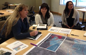
Participants at a training workshop in Torrance, California, in November discuss regional projections of sea level rise and coastal storms.
USC Sea Grant also is working with the U.S. Geological Survey on outreach for the latest version of the USGS Coastal Storm Modeling System (CoSMoS) that applies to the entire Southern California Bight.
The Sea Grant vulnerability report for the city was based on a pilot version of the USGS modeling system, called CoSMoS 1.0, that makes predictions of storm-induced coastal flooding based on a moderately severe storm that occurred in the region in January 2010. It models storm-driven sea level rise for two future climate scenarios, which can help emergency responders and coastal planners anticipate storm hazards and make plans to allocate resources to deal with them.
The Southern California version of CoSMoS 3.0 is in development now; some results are expected to be released in 2015 and the full suite of studies completed in summer 2016. Enhancements to the USGS program include models for long-term evolution of coastal environments, including sandy beaches and cliffs, models for discharge from rivers and long-term sediment supply to coastal waters and includes a full spectrum of sea level rise and storm scenarios.
Funding for CoSMoS 3.0 comes from the California Coastal Conservancy along with support from the Tijuana River National Estuarine Research Reserve and California Department of Fish & Wildlife. The updated CoSMoS project includes support from the Coastal Conservancy for USC Sea Grant to handle outreach to local communities.
“It’s our job to train planners and stakeholders from coastal communities to utilize the models,” Grifman said. “Our job now is ‘capacity building’ in the Southern California Bight.”
To that end, USC Sea Grant recently ran workshops in San Diego and L.A. and will organize others in Santa Barbara and Orange County.
“This is all about resilience,” Grifman said. “It’s about how communities can prepare so they don’t suffer huge losses, and the time to do that preparation is now, not when they start seeing losses.”
Grifman said the problems that might be caused by rising sea levels would most likely be the result of storm events that occur during high tides. As an example, she pointed to the enormous waves that hit the Southern California coastline in August as a consequence of a hurricane far offshore. Hurricane Marie was hundreds of miles offshore and produced 10-to 20-foot waves along the coast and on Catalina Island. (At its peak, Hurricane Marie was a Category 5 hurricane, the same level as Hurricane Katrina in 2005, but unlike Katrina, Marie never made landfall.)
“That was a storm-based event coupled with high tides, and we saw enormous waves across southern California,” Grifman said. “That’s the kind of thing we think of as a harbinger, an example of what our future is going to look like.”